August is designated as the country’s History Month simply because many events that transpired during this month molded the Philippines into the country that it is now. In the spirit of celebrating such a meaningful month, we once again bring to life the story of two of the most, if not the most, iconic roads in the country. An airport-turned-major CBD thoroughfare and a highway that has gone through several renamings. This is the story of the Nielson Field, where the famous Ayala Triangle is located, and the highway that became the venue for various historical drifts in the country, EDSA.
Nielson Field, the remnants of one of Manila’s first
Despite the presence of the first commercial airport in Grace Park airfield in Caloocan, Laurie Nielson, a British national, dreamt of building an international airport and an aviation school in the Philippines. With nearly 90 years of history, Manila’s first principal airport was built when Zobel de Ayala leased a portion of Hacienda de Makati for Nielson to bring his aspirations to life. Through this, he established the Far Eastern School of Aviation, later called FEATI. By July 1937, the Manila International Airport went into full operation when it became home to the first air shuttle services in the country, the Philippine Air Taxi Company (PATCO), and the Iloilo Negros Air Express Company (INAEC).
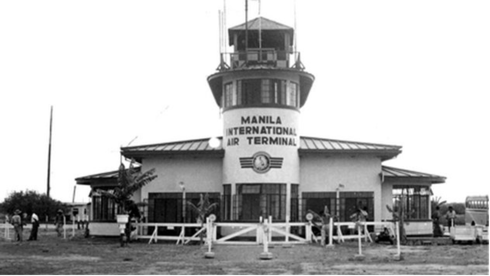
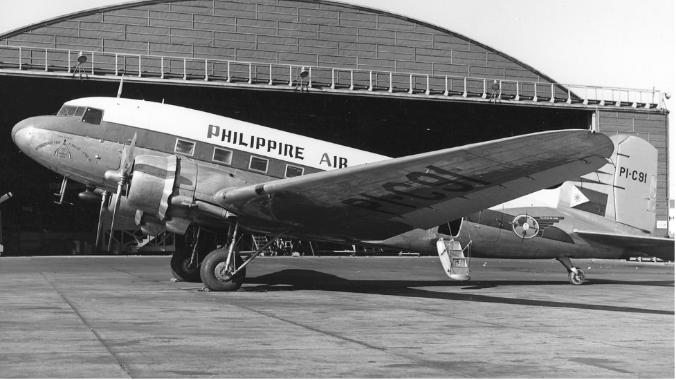
By 1941, prior to the Japanese occupation of the country, the San Miguel Corporation, led by Andres Soriano Sr., absorbed PATCO, which later produced the first Philippine flagship aircraft, the Philippine Airlines. The Nielson Field is where the first Philippine Airlines commercial flight was flown from Manila to Baguio. Shortly after, the Japanese troops took over Manila and targeted major installations, including the Nielson Field. It became a military headquarters by 1942 with Laurie Nielson nowhere to be heard and found, after he was detained in the University of Santo Tomas Interment Camp and sent to Hong Kong.
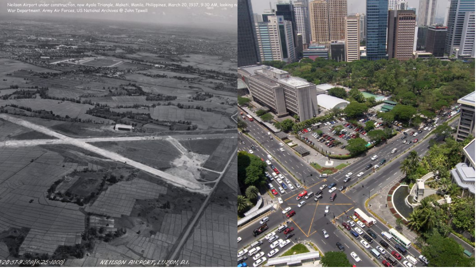
Three years later, the joint forces of Filipino and American soldiers took back Nielson Field during the Battle of Manila. A year later, it was reopened only to be completely shut down by 1948. So, when Manila’s aviation was moved to Nichols Field, now Ninoy Aquino International Airport, Zobel de Ayala took back control of the land where Nielson Field is located in the hopes of preserving the area while building a business district around it. Today, Nielson Field is surrounded by the towering skyscrapers of Makati Central Business District, the financial center of the Philippines. The two runways, now Paseo de Roxas and Ayala Avenue, became major thoroughfares of the business district and sites for various historical events in the country.
The highway of many names
When Dan Brown described Manila as the gates of hell, we were all gutted. Though if you read his bestselling novel, Inferno, you’d know that he did not describe it that way to demean the country but rather to express the actuality of living his character had witnessed in Manila. That included the six-hour traffic jam on probably one of the world’s most notorious highways when it comes to traffic, EDSA.
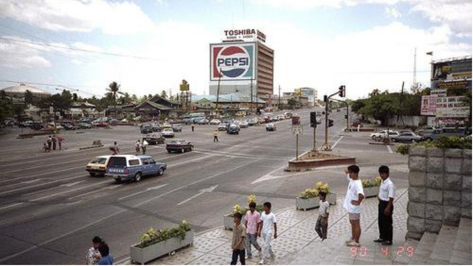
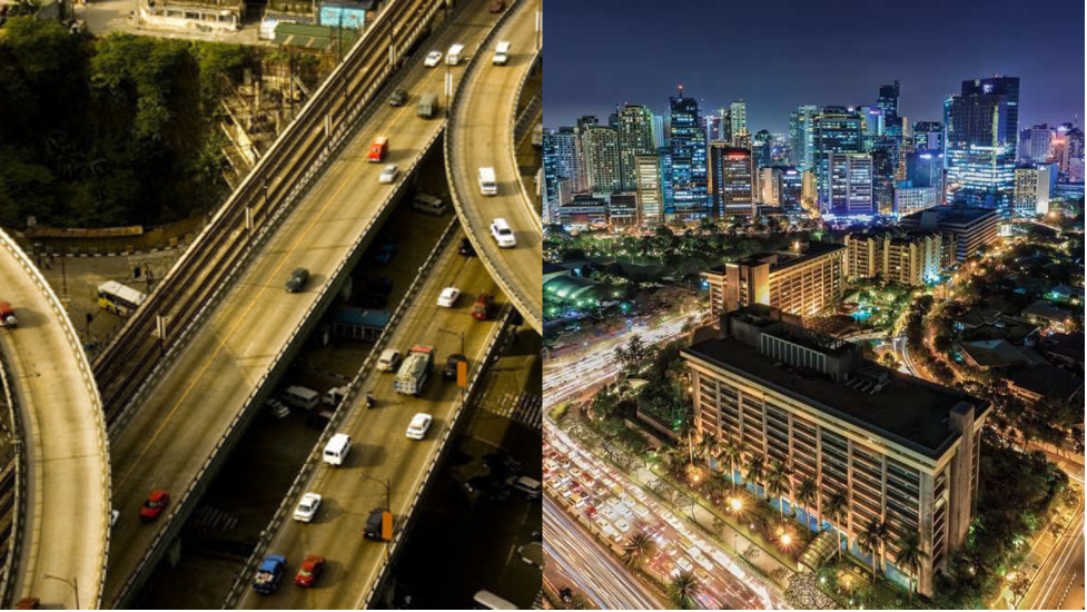
The Epifanio de los Santos Avenue, or EDSA, is the major artery of Metro Manila. Servicing 16 cities and 1 municipality in the capital region and passing through six cities with its 23.8-kilometer length, this highway has become the focal point for present-day travels that will test anyone’s patience. But before all the traffic-related horrors, it was also the venue for some of the most important historical events that truly changed the Philippines’ historical landscape.
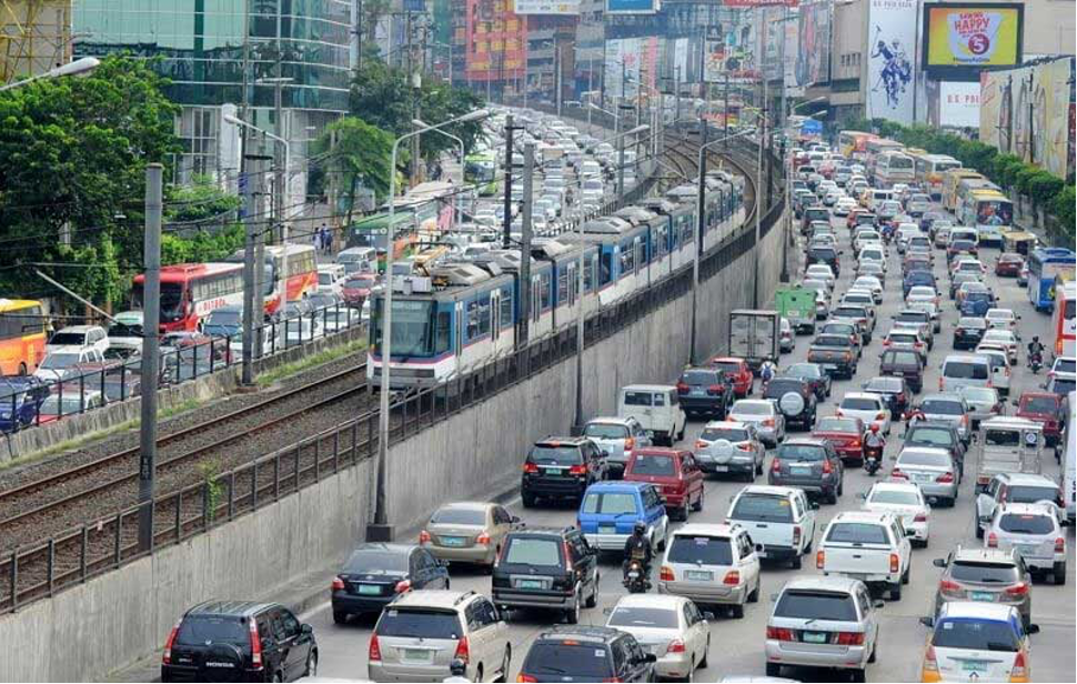
Despite being one of the longest highways in Metro Manila, it is also the most congested with approximately 330,000 vehicles passing through its lanes daily. Though EDSA is evidently part of the lives of people living in the metro, naming a thing or two about the person it was named after may prove to be a bit of a challenge to many. Epifanio de los Santos is a Rizaleño historian, author, and scholar from Malabon. He translated the now Philippine literary classic, Florante at Laura, by another great poet and author Francisco Balagtas.
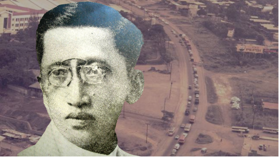
Apart from being an associate editor of the revolutionary paper “La Independencia,” he also wrote several biographies including those of our national heroes Jose Rizal and the father of Philippine Journalism, Marcelo H. del Pilar, to name a few. Popularly known as Don Panyong, he also served as the provincial secretary and governor of Nueva Ecija. He later contributed the rest of his expertise as the director of the Philippine Library and Museum.
Why the name change?
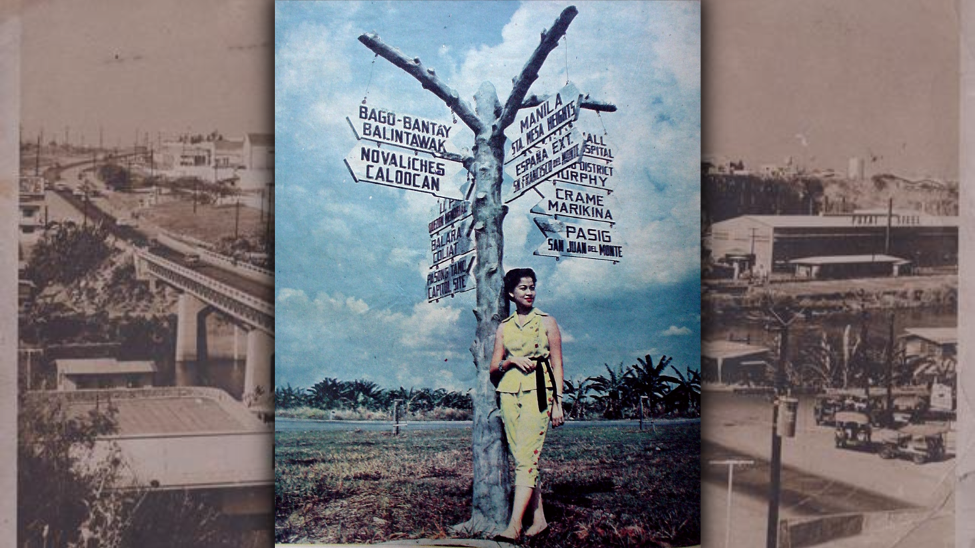
During the American occupation, EDSA carried several names prior to its renaming. It was built as the North-South Circumferential Road and was known as Manila Circumferential Road or simply, Circumferential Road. For reasons still unclear, this name was changed to Highway 54 — with some speculating that it was renamed to pay tribute to the people who built it, the 54th Army Engineering Brigade led by Osmundo Monsod and Florencio Moreno.
When the country achieved its independence from the United States in 1946, Highway 54 was again renamed Avenida 19 de Junio, citing Jose Rizal’s birthday since the majority of Metro Manila was still under the Rizal Province. It was only in 1974 that 12 towns of Rizal were incorporated into the newly-established Metro Manila.
Despite then-president Ramon Magsaysay wanting it changed to Rizal, the majority of the residents of Rizal Province expressed that they wanted it named after a Rizaleño. Various historical committees in the country, led by Rizaleños Eulogio Rodriguez Sr. and Juan Sumulong supported the renaming of the avenue to another Rizaleño who had significant contributions to the country.
According to historian Ambet Ocampo, some of their considerations were Teodoro Agoncillo, Horacio de la Costa, and Gregorio Zaide. However, they were still alive at that time, which was why de los Santos became the option. Aside from the fact that no street was named after him yet, he was a historian and a Rizaleño; two of the criteria they were considering back then for the renaming of the highway. To honor the Rizaleño historian’s birth anniversary, on April 7, 1959, Avenida 19 was formally renamed Epifanio de los Santos Avenue.
Relevant then, and still relevant now.
From toppling a dictator in a bloodless revolution to housing the country’s financial center, these two major thoroughfares continue to be part of our history. Despite urbanization around the Nielson Tower and EDSA, may we never forget the cultural and historical significance of these places. As we cross these roads, may they be reminders of the stories of resilience and patriotism embedded on their grounds.
The next time you get stuck in traffic or experience trouble while on the road, look for the spots that will remind you of their significance, like the EDSA Shrine, or the Nielson Tower where the famous Blackbird restaurant is now occupying. But if your car breaks down, and would need help getting back on the road, you are in luck because you can find help through a brand that has seen these two places even before they came to be; Motolite. It’s called pangmatagalan for a reason, yes? Now, if you get stuck in the posh streets of Ayala Avenue or on the longest highway in the metro, with just a few taps on your mobile phone through the Motolite RES-Q app, help will get to you in no time.
So even if knowing how long you would have to stay on these roads can become unpredictable, make sure that you have a reliable and truly pangmatagalan backup with you. Who would know it best than the brand that has seen it all? Try to beat that.